History & Geography
1. Introduction: The Geopolitical Significance
The history of Saqiya is not merely a chronicle of a single settlement but a microcosm of the broader demographic, economic, and political transformations that shaped the Jaffa hinterland over the last half-millennium. Located 8.5 kilometers east of Jaffa, Saqiya existed at the intersection of ancient agricultural traditions and the rapid modernization brought about by the global citrus trade.
Contrary to narratives suggesting the coastal plain was devoid of settled habitation until late migrations, Saqiya represents a continuous, evolving community documented as early as the 16th century.
2. Etymology: The Hydraulic Engine
2.1 Technological Determinant
In Arabic, Saqiya (ساقية) refers to a water wheel, specifically an animal-powered mechanism used to lift water from a well to an irrigation ditch. Unlike the noria (driven by river currents), the saqiya utilize gears to convert the circular motion of a draft animal into the vertical lifting of water jars.
The naming of the village “Saqiya” implies that this device was its defining feature. While hill villages were named after topography, Saqiya was named after its infrastructure. This mastery of hydraulic engineering allowed for intensive summer crops (citrus and vegetables) rather than just winter cereals.
2.2 Social Complexity
Maintaining a saqiya required specialized carpentry, a steady supply of draft animals, and complex social management of water rights. This stability predates the Ottoman conquest, suggesting the village coalesced around a central irrigation complex that served as its economic heartbeat.
3. Founding: Chronology and Records
3.1 The 1596 Ottoman Tax Register
Saqiya is explicitly recorded in the 1596 Defter-i Mufassal in the Nahiya of Ramla. The register describes a fully functioning, thriving village rather than a new outpost.
Socio-Economic Profile (1596)
| Metric | Value | Implications |
|---|---|---|
| Households | 49 | A settled core population of families. |
| Est. Population | ~270 | A medium-sized village for the era. |
| Composition | 100% Muslim | Religious homogeneity in the early modern period. |
| Taxable Assets | Wheat, Barley, Sesame, Fruit | Diversified subsistence and cash crops. |
| Livestock | Goats, Beehives | Supplemented by pastoralism and apiculture. |
The existence of 49 households in 1596 suggests the village was likely established significantly earlier, potentially during the Mamluk period (1250–1517) or the early Arab period.
3.2 The 18th Century: Survival and Connectivity
The Syrian Sufi traveler Mustafa al-Bakri al-Siddiqi passed through Saqiya in the mid-18th century. This mention confirms that the village survived the turmoil of the 17th/18th centuries—a period of declining central authority—and remained a node on the primary route connecting the interior to the port of Jaffa.
4. Historical Geography
4.1 Local Connectivity
Saqiya was a bridge between the urban coast and the interior. It was linked by roads to:
- Kafr ‘Ana (North)
- Al-Khayriyya (West)
- Bayt Dajan (South)
- Lydda District (East)
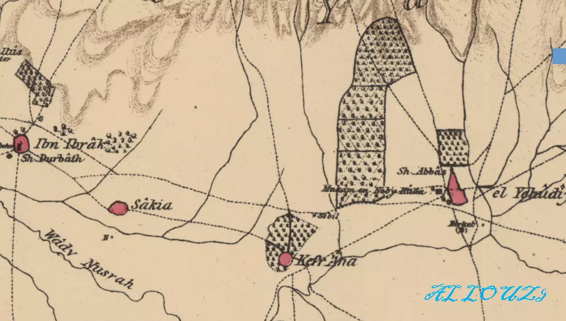 Historical map from 1880 showing the village and its neighbors.
4.2 Mapping the Core
The Survey of Palestine (Sheet 13-15) shows a dense residential core of stone and adobe, which expanded significantly with concrete buildings during the Mandate era as wealth from the citrus orchards poured back into the village.