Society & Economy
4. Origins of the Populace: A Demographic Tapestry
The “people of Saqiya” were a composite of three distinct demographic layers:
- The Indigenous Core (The Fellahin Base): The 1596 tax record establishes a continuous Muslim presence for at least four centuries. Genetic and cultural continuity suggests the core families were sedentary inhabitants of the region who evolved in place.
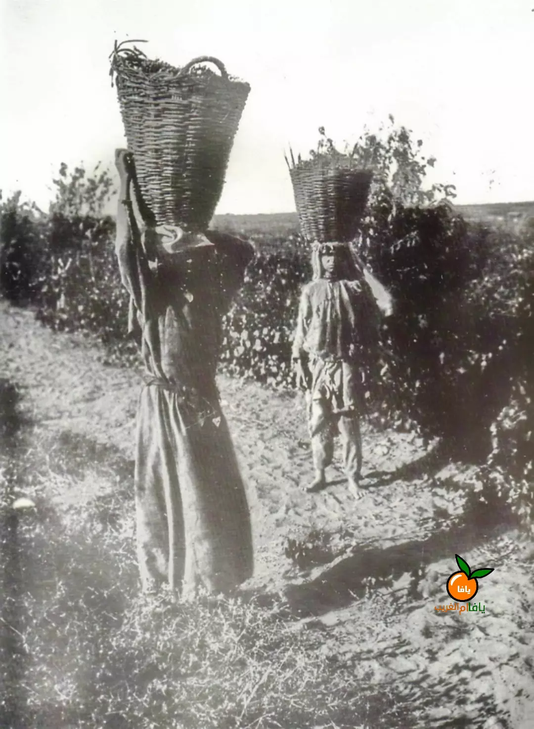 A rare 1922 photograph of women from Saqiya harvesting grapes.
- Internal Highland Migration: During the late Ottoman period, improved security led to a drift of families from the resource-poor mountains (Hebron, Nablus) to the fertile coast, drawn by the “Orange Boom.”
5. Social Structure and Genealogy: The Clans
The social organization was centered on the Hamula (clan), the primary unit of social security and political representation.
5.1 Prominent Families
- Al-Nadi: A land-owning elite who held the Mukhtarship for significant periods.
- Atta (Attia): A dominant political force holding the “First Mukhtar” position as early as 1916.
- Al-Badri: Shared the Mukhtarship during the Mandate era to maintain clan balance.
- Al-Jawhary: A registered family with a significant diaspora presence today.
- Other Clans: Abu Ajwa, Abu Hashish, Damisi, Sallam, and Al-Sheikh Hassan.
5.2 The Institution of the Mukhtar
Late Ottoman Period (c. 1916):
- First Mukhtar: Hassan Hussein Atta.
- Second Mukhtar: Mustafa Nadi. (This dual structure prevented any single family from monopolizing village influence).
British Mandate (1930s-1940s):
- Mukhtars: Sheikh Hussein Abd al-Al al-Nadi, Sheikh Yusuf al-Badri, and Jaser Muhammad Ali Atiyeh.
6. Demographics and Economy
6.1 Population Growth (1922–1948)
| Year | Source | Population | House Count |
|---|---|---|---|
| 1922 | British Census | 427 | - |
| 1931 | British Census | 663 | 142 |
| 1945 | Village Statistics | 1,100 | - |
| 1948 | Pre-War Estimate | ~1,276 | 273 (est) |
6.2 The Citrus Revolution (1945 Data)
Saqiya was a powerhouse of citrus production. Over 40% of the land was dedicated to cash crops.
| Land Use Category | Area (Dunams) | Insight |
|---|---|---|
| Citrus & Bananas | 2,422 | Over 40% of total land area. |
| Cereals | 2,534 | Maintained for self-sufficiency. |
| Irrigated/Orchards | 145 | Vegetables and soft fruits. |
| Total Land | 5,850 | Owned ~88% by Arabs. |
Analysis: This was a highly monetized economy. Villagers were not just peasants; they were farmers engaged in international trade capitalism through the Jaffa Port.
6.3 Infrastructure & Education
- Architecture: Transitioned from adobe to modern concrete in the 1940s.
- Education: A boys’ elementary school founded in 1936 with 16 dunums of land for agricultural training.
- Religion: A new mosque opened shortly before the end of the Mandate, a symbol of civic pride.